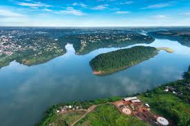
A bridge is a structure built to span a physical obstacle, such as a body of water, valley, or road, without closing the way underneath. It is constructed for the purpose of providing passage over the obstacle, usually something that is otherwise difficult or impossible to cross. There are many different designs that each serve a particular purpose and apply to different situations. Ancient people would also have used log bridges; that is a timber bridge that fall naturally or are intentionally felled or placed across streams. Some of the first man-made bridges with significant span were probably intentionally felled trees. Among the oldest timber bridges is the Holzbrucke Rapperswil-Hurden crossing upper Lake Zurich in Switzerland; the prehistoric timber piles discovered to the west of the Seedamm date back to 1523 BC. On April 6, 2001, the reconstructed wooden footbridge was opened, being the longest wooden bridge in Switzerland.
The Romans built arch bridges and aqueducts that could stand in conditions that would damage or destroy earlier designs. Some stand today. An example is the Alcantara Bridge, built over the river Tagus, in Spain. In India, the Arthashastra treatise by Kautilya mentions the construction of dams and bridges. A Mauryan bridge near Girnar was surveyed by James Princep. The use of stronger bridges using plaited bamboo and iron chain was visible in India by about the 4th century. Rope Bridges a simple type of suspension bridge, were used by the Inca civilization in the Andes mountains of South America, just prior to European colonization in the 16th century. A major breakthrough in bridge technology came with the erection of the Iron Bridge in Shropshire, England in 1779. It used cast iron for the first time as arches to cross the river Severn. Humans have built some astonishing bridges around the world. Longest Bridges are more than 3 kilometers (1.9 mi) in length sorted by their full length above land and water. The main span is the longest span without any ground support. Here is a list of the world’s longest 10 bridges in the world.
1.Danyang–Kunshan Grand Bridge(China)
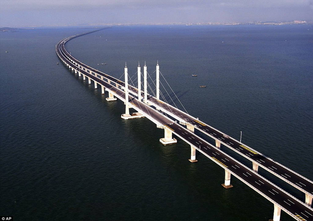
Danyang–Kunshan Grand Bridge is a 164.8-kilometre-long (102.4 mi) viaduct on the Beijing–Shanghai High-Speed Railway and it was completed its construction in 2010. As of June 2011, Danyang-Kunshan Grand Bridge in China held the Guinness World Record for being the world’s longest bridge. This bridge can bear the direct impact from naval vessels weighing 300,000 tons or less. It is the world’s longest bridge. Being a mega dream project, it was expected to bring a boom in China’s communication infrastructure. China gave a boost to its industrial capabilities from early 2000 by planning to construct several long bridges. With the construction of Danyang-Kunshan Grand Bridge, China easily overcame its massive public and industrial transportation system. This bridge plays a pivotal role to connect the country’s prominent industrial hubs. Danyang-Kunshan Grand Bridge connects China with the Beijing–Shanghai High-Speed Railway. The railway that the bridge connects spans 818 mi (1317 km), and is an engineering feat of its own.
The Construction of the Danyang–Kunshan Grand Bridge lasted four years and resources costing $8.5 billion. Linking popular metropolitan cities of China, namely Shanghai and Nanjing in the Jiangsu Province, this overpass bridge is the lifeline of the nation. In operation since June, 2011, Danyang-Kunshan Grand Bridge runs parallel to China’s renowned Yangtze River for approximately 8 to 80 kilometers in the southern side of the river. This bridge touches many populated areas, namely Danyang, Changzhou, Wuxi, Suzhou, and Kunshan, among others. A robust team of 10,000 men, including core laborers, engineers and rest professionals, worked dedicatedly to ensure that its construction of the longest bridge in Asia could complete in the stipulated time frame. This bridge has been constructed in a way that it is capable to bear natural disasters like typhoons and at least 8 magnitude earthquakes this bridge from the ground is 100 feet. The capital city of China’s Jiangsu Province, Nanjing is a popular urban area that remains connected to Shanghai on the other side through the world’s largest bridge Danyang-Kunshan Grand Bridge. This East Chinese city is located on the famous Yangtze River Delta region, Nanjing. This area is known for rich traditions and cultural vibrancy.
2.Changhua–Kaohsiung Viaduct Bridge(Taiwan)
Changhua-Kaohsiung Viaduct is the world’s second longest bridge. This bridge is 157.317 km (516,132 ft) or 97.8 miles in length and it was completed in 2007. The railway is built across a vast series of viaducts, as they were designed to be earthquake resistant to allow for trains to stop safely during a seismic event and for repairable damage following a maximum design earthquake. Bridges built over known fault lines were designed to survive fault movements without catastrophic damage. The bridge goes from Baguashan in Changhua County to Zuoying in Kaohsiung. THSR Changhua, Yunlin, Chiayi, Tainan stations are built along this viaduct. Changhua–Kaohsiung Viaduct Bridge Completed its construction in 2007. Over 200 million passengers had been carried over it by December 2012. The bridge acts as a viaduct for part of the railway line of the Taiwan High Speed Rail network.
3.Tianjin Grand Bridge(China)
Tianjin Grand Bridge is one of the longest bridges in the world with a total length of about 113.700km, or 70.6 miles. It is one of the high-speed trains that dart from Beijing to Shanghai is like taking a trip through the thousand faces of China. The route also includes the entrance to a tunnel over 6 km (3.7 miles) long that connects two artificial islands. A few kilometers from Tianjin’s skyscrapers, European-style buildings and the upscale residential area of Wudadao (the city’s Five Great Boulevards), a viaduct soars over the city for 113 kilometres (70 miles). Tianjin Grand Bridge is very complex project. This city of 15 million inhabitants is known for the vitality of its port. Tianjin home to an incredible infrastructure. Its massive span races the high-speed railway line between Beijing and Shanghai, one of the busiest and most profitable sustainable mobility routes in the country.
Much of the viaduct runs through the densely populated urban area surrounding the metropolis. The idea of running the high-speed train along an elevated viaduct was a smart solution: every kilometre of railway built on the ground would have required 28.4 hectares (70 acres) of earthworks, and therefore would have had a devastating environmental impact on the urban area. The viaduct was designed in 32 sections, each weighing 860 tons. Work on the project began in 2006 and was completed in 2010, with the inauguration on June 30, 2011. In order to achieve all this, the government made the huge investment of around $20 billion, made possible by China’s development policies. The latitude of Tianjin Grand Bridge, Hebei, Tianjin, China is 39.056084, and the longitude is 117.054947.
4.Cangde Grand Bridge(China)
Cangde Grand Bridge is the world’s fourth longest bridge. It was finished in 2010. The length of Cangde Grand Bridge is 105.810 km. The bridge is a part of the Beijing–Shanghai High-Speed Railway and is the third longest bridge on the railway in 2010. The bridge has been designed with a view to withstanding earthquakes. The total length of the Cangde super-large bridge is 105.81 km (65.75 mi) and it has a total of 3092 piers. Like the Beijing Grand Bridge, this one also carries a high-speed railway connecting Beijing and Shanghai. Its length is 380,210 feet. This bridge is to provide with the structural stability it needs to stay intact despite any tectonic shifting and destructive forces. The Cangde Grand Bridge also crosses the Wei River and several other, smaller rivers.
5.Weinan Weihe Grand Bridge(China)
The Weinan Weihe Grand Bridge is a part of the Zhengzhou–Xian High-Speed Railway which connects Zhengzhou and Xi’an, in China. This bridge series is also in China and is also a viaduct for high speed rail. The length of this bridge is 79.732-kilometer (49.543 mi). Weinan Weihe Grand Bridge crosses the Wei River twice, as well as many other rivers, such as the Ling river, Luofu river, Xi river, Shi Di river and many more, highways and railways. Upon its completion, it was the longest bridge in the world, but surpassed by two new bridges on Beijing–Shanghai High-Speed Railway that completed in 2010.
During construction of the Weinan Weihe Grand Bridge, there were at least 10,000 workers 2,300,000 cubic meters of concrete and 45,000 tons of steel. The bridge was completed in 2008. It seems like these days although this is not a bridge with a highway it is still a bridge and the 5th longest in the world currently with a length of approximately 80 kilometers. This bridge was once the longest bridge in the world but not for long, as the other two new bridges on Beijing–Shanghai High-Speed Railway that completed in 2010.
- The Bang Na Expressway (Thailand)
Bang Na Expressway in Bangkok, Thailand, is not only the longest bridge in the world, but also represents the largest precasting operation ever carried out. This is a wonderful bridge construction, one of the longest bridges in the world. The construction of the main road started in 1995 and lasted for five years. Officially, the bridge was opened in February 2000. The bridge length is 54 kilometers, and the width is 27.2 meters. There are three lanes in each direction. The Bang Na Expressway was designed by the late Louis Berger. The impressive sum, more than 1 billion US dollars was invested in the construction of this wonderful bridge. It took 1,800,000 cubic meters of concrete to build the bridge. The bridge was completed in January 2000. Traffic congestion has been one of Bangkok’s main problems for several years. To solve this problem, Bang Na Magistrate was built. Although traffic on the bridge is chargeable, Bang Na remains very demanding for the drivers since opening.
The variant on the bridge instead of the strenuous traffic jam, also attracts the numerous tourists. From the main road, the wonderful panoramas open onto the city. The bridge was built over the busy 34 motorway, which is considered one of the city’s traffic-congested and difficult streets. The leading engineers and architects from Thailand and the USA, whose number was also Gin M.Mullers, have participated in the development of the bridge project. The bridge construction has demanded more than 1.8 million cubic meters of concrete, which ensures the high reliability and resilience of the bridge. It provides an important link in the transportation system around Bangkok and is expected to play a major role in the commercial development of Southeast Thailand. The world’s longest car bridge, the Bang Na Expressway, held the title of the world’s longest bridge from 2000 until 2008. The title of ”world’s longest bridge” is an honorific that has been proudly held by several structures throughout history.
- Sheikh Jaber Al-Ahmad Al-Sabah Causeway(Kuwait)
The Sheikh Jaber Al Ahmad Al Sabah causeway project includes two causeway paths over the Kuwait Bay. The Sheikh Jaber Al-Ahmad Al-Sabah Causeway is a mega bridge project with an estimated construction value of approximately US$3 billion. Kuwait Ministry of Public Works (MPW) involved the construction of a 36km road to Subiyah and a 13km connection to Doha. Construction commenced in November 2013 and the causeway was officially inaugurated in May 2019. The causeway project reduces the distance between Kuwait City and Subiyah in the northern part of Kuwait, as well as decreases the travelling time from 90 minutes to less than 30 minutes. The main causeway or the Subiyah connection is 36km-long, 27km of which is a marine bridge connection. A signature element of the causeway is a main cable-stayed bridge featuring a 200m span and an arc pylon.
Sheikh Jaber Al-Ahmad Al-Sabah Causeway also includes an elevated road and 5km of access roads connecting to the Subiyah area. A free-flowing interchange at the port links to Kuwait City’s road network. The project also included the construction of two 30ha artificial islands, which feature traffic and emergency service buildings, maintenance facilities, a gas station and a boat dock. The islands include a 23m-high navigation causeway and a 120m navigation opening for passing ships. It is one of the largest and most challenging transport infrastructure projects in Kuwait, as well as the entire Middle East region. The government is also developing a new residential area, named as the Silk City, in Subiyah for 500,000 inhabitants. The city is being developed to renew the ancient Silk Road trade route between China and Kuwait.
- Beijing Grand Bridge(China)
Beijing Grand Bridge is a 48.153 kilometres long railway viaduct on the Beijing–Shanghai High-Speed Railway, located in Beijing. Longest span of this Beijing Grand Bridge is 44 m (144 ft). It was completed in 2010 and opened in 30 Juna, 2011. It is one of the longest bridges in the world. The Beijing Grand Bridge links the two cities to provide arguably the most valuable transit connection in China in just around five hours. The bullet train that utilizes the Beijing Grand Bridge travels at speeds between 155mph and 185mph and offers different options for passengers. The Beijing–Shanghai high-speed railway is also known as the Jinghu high-speed railway. More than $8.5 billion US dollars was invested in the construction of this wonderful bridge.
- Lake Pontchartrain Causeway(United States)
The Lake Pontchartrain Causeway, sometimes only the causeway, is a fixed link composed of two parallel bridges crossing Lake Pontchartrain in southern Louisiana, United States. The longer of the two bridges is 38.35 km (23.83 miles) long. The southern terminus of the causeway is in Metairie, Louisiana, a suburb of New Orleans. The northern terminus is at Mandeville, Louisiana. Lake Pontchartrain Causeway became the longest bridge over water (continuous) while Jiaozhou Bay Bridge the longest bridge over water (aggregate). The bridges are supported by 9,500 concrete pilings. The two bridges span the navigation channel 8 miles (13 km) south of the north shore. In 1969, Louisiana’s lake Pontchartrain Causeway was officially recognized by Guinness World Records as the longest bridge over water in the world.
Heading east or west around the lake was a time-consuming process, so plans were made to create a direct connection across the center of the lake to its northern shore. In 1955, the Louisiana Bridge Company was created to undertake the construction project. It took just 14 months to build the first two-lane span of the causeway, which opened in 1956. The Lake Pontchartrain Causeway was officially recognized as the longest bridge over water in the world, a record it held unchallenged until 2011.The second bridge was opened in 1969, separated from the original by about 84 feet. The second span was only about 50 feet longer than the original, but it was enough to finally catch the attention of the Guinness Book of World Records.
- Line 1 of Wuhan Metro Bridge(China)
The first metro line in Wuhan, the capital of the Hubei province of China, became operational in September 2004. Wuhan is located at the meeting point of two rivers, Han and Yangtze, and the main purpose of constructing the metro is to ease traffic congestion on the bridges across the Yangtze River. Operational since December 2012, line 2 of the metro is partly underground, whereas line 1 is completely elevated. The high-speed light rail project is managed by Wuhan Metro Group, and aims to provide a fast, safe, energy-saving and dependable mode of transport. Wuhan Metro will have eight lines in total.
Line 1 is 29km-long and covers 25 stations, carrying more than 220,000 passengers on 33 trains. The first phase of the line was opened in 2004, while phase II entered commercial service in July 2010. The phase III expansion, extending the north-east terminus to Hankou North Station, entered commercial service in May 2014. The first phase of Wuhan Metro line 2 is 27.73km-long with 21 stations, linking the Hankou and Wuchang Districts. The dual-track, fully electrified line carries up to 800,000 passengers. The Line 1 of Wuhan Metro is the longest continuous metro viaduct in the world. Line 1 opened on 28 July 2004, making Wuhan the fifth city in mainland China to have a metro system after Beijing, Tianjin, Shanghai and Guangzhou. This is the first Metro line in China incorrectly referred to as a light rail line in Chinese terminology. Length of this bridge is 37.788 km.

