Freshwater lakes are bodies of still, unsalted water surrounded by land. They are usually found in low lying areas and are fed from streams, rivers and runoff from the surrounding area. Lake, any relatively large body of slowly moving or standing water that occupies an inland basin of appreciable size. Definitions that precisely distinguish lakes, ponds, swamps, and even rivers and other bodies of non oceanic water are not well established. Fresh water can be defined as water with less than 500 parts per million (ppm) of dissolved salts. Water is critical to the survival of all living organisms. 3% of the earth’s water is fresh. 2.5% of the earth’s fresh water is unavailable: locked up in glaciers, polar ice caps, atmosphere, and soil; highly polluted; or lies too far under the earth’s surface to be extracted at an affordable cost. 0.5% of the earth’s water is available fresh water. Here are the top 10 largest freshwater lakes by Surface Area in the world.
1.Lake Superior

Lake Superior is the Largest fresh water lake by surface area. It has taken into the account of the saline Caspian sea. Lake Superior has been described as “the most oligotrophic lake in the world.” It is also the second largest lake in the world. It is shared by the USA and Canada, also the part of the Great Lakes of North America. Lake Superion occupies an area of 82,400 square kilometers. These magnificent freshwater lakes are not only beautiful, but also essential for human survival. Lake Superior is home to 88 species of fish. Lake Superior contains 10% of all the earth’s fresh surface water. The deepest point in Lake Superior (about 40 miles north of Munising, Michigan) is 1,300 feet (400 meters) below the surface. Lake Superior has over 400 islands, the largest of which is Isle Royale, with a size of 207 square miles. The lake has an island called the Isle Royal, which contains many smaller lakes, which in turn have their own islands as well. The Lake Superior shoreline, if straightened out, could connect Duluth and the Bahama Islands.
The average underwater visibility of Lake Superior is 27 feet, making it easily the cleanest and clearest of the Great Lakes. Underwater visibility in places reaches 100 feet. The lake is home to many endemic species of fish, however, some have been wiped out due to overfishing and exotic species being introduced. The lake’s primary inflows are the Nipigon River, the St. Louis River, the Pigeon River, the Pic River, the White River, the Michipicoten River and the Kaministiquia River. The only outflow of Lake Superior is the St. Mary’s River. We must srtive to protect these from further degredation, for our sake, and for the sake of their intrinsic value. Water in Lake Superior is retained, on average, 191 years. Migrating birds of prey funnel down Lake Superior’s north shore in great numbers each fall. On a single day at Duluth’s Hawk Ridge as many as 100,000 birds of prey might pass by. Lake Superior rests mostly on Precambrian rock at the southern edge of the Canadian shield, the largest exposure of such bedrock on the planet.
2.Lake Victoria
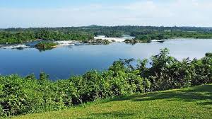
Lake Victoria is the world’s largest tropical lake and the second largest freshwater lake. It has 69,485 square kilometres area and is shared by Kenya, Uganda and Tanzania. It covers with a maximum depth of 80 m it is relatively shallow. A population of over 30 million people live in its basin. Lake Victoria is one of the African Great Lakes and is named after Queen Victoria. There are 84 islands inside the lake itself. In Lake Victoria the water hyacinth caused a reduction in fish through de-oxygenation of water, blocking of the in flow and out-flow of the lake, and disruption in fishing activities and lake transportation in late 1990s. Water hyacinth is a fresh water plant capable of vigorous growth. It was introduced on the African continent as an ornamental plant in early 20th century, and since then has spread rampantly. This massive lake, commonly known as Nyanza, is twice the size of Wales, and forms a natural boundary between Kenya, Tanzania and Uganda. The lake is the heart of the African continent, the source of its mightiest river, the Nile.
This mighty body of water is rich in fish life, with shimmering shoals of colourful cichlids and large Nile Perch. The ecological health of Lake Victoria has been affected profoundly as a result of a rapidly growing population, clearance of natural vegetation along the shores, a booming fish-export industry, the introduction of several exotic plant and animal species, the disappearance of about 50 % of its fish species, prolific growth of algae, and dumping of untreated effluent by several industries and human settlements. It has suffered tremendously in terms of biodiversity due to the introduction of new exotic species and water pollution. As a result, the fishing industry of the area has also suffered. The lake receives water from annual rainfall, as it lies in the tropical regions. Lake Kagera is also one of the sources of water. The lake’s outflow is the river Nile, which is most famous.
3.Lake Huron
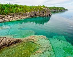
West of Lake Michigan is Lake Huron, which is shared between USA and Canada. The lake reaches a maximum depth of 750 ft. It has a surface area of 59,600 square kilometres but has lower volumes of water than Lake Michigan. The name of the lake is derived from early French explorers who named it for the Huron people inhabiting the region. The Huronian glaciation was named due to evidence collected from Lake Huron region. The northern parts of the lake include the North Channel and Georgian Bay. Lake Huron was originally called La Mer Douce, or “the freshwater sea,” by French explorers. It has the longest shoreline of the Great Lakes. Mackinac Island is a popular tourist attraction. It is home to the Manitoulin Island, which is the largest island to be found in any lake throughout the world.
Lumbering and fishing have been important economic activities in the Lake Huron region, and many resorts line the lake’s shores. The Saginaw River basin is intensively farmed and contains the Flint and Saginaw-Bay City metropolitan areas. The lake was once home to a number of fish and other species of animals, but this has suffered due to the introduction of exotic and invasive species post colonisation. As part of the St. Lawrence Seaway, the lake supports heavy commercial traffic in iron ore, grain, and limestone. The primary inflows of the glacial lake are the Straits of Mackinac, the St. Marys River. The main outflow of this river is the St. Claire River. The lake is 206 mi (331 km) long from northwest to southeast, and its maximum width is 183 mi.
4.Lake Michigan
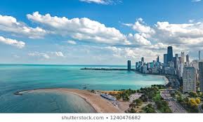
Lake Michigan is one of the five Great Lakes of North America. Lake Michigan is the only one of the Great Lakes located entirely within one country, the United States. Dipping the toes into the freshwater and watching a Pure Michigan sunset will become a great experience in the life. It is shared, from west to east, by the states of Wisconsin, Illinois, Indiana, and Michigan. Green Bay is a large bay in its northwest and Grand Traverse Bay is in the northeast. Michigan’s western Great Lakes region benefits from a unique climate, which creates a favorable environment for growing a wealth of agricultural products. The word “Michigan” is believed to come from the Ojibwe word Michi Gami meaning “large lake”. This lake is with a water surface area of 22,300 square miles. The lake also contains numerous islands, notably the Beaver Island archipelago and the North and South Manitou Islands located between the Upper and Lower peninsulas. Approximately 100 streams flow into the lake, only a few of which are of appreciable size. The Manistee, Pere Marquette, White, Muskegon, Grand, Kalamazoo, and St. Joseph rivers enter the lake from the east.
There are 59 lighthouses that stand on the beaches of Lake Michigan as reminders of the importance of the centuries-old shipping industry, a story told well at the Michigan Maritime Museum in South Haven. The state is a leader in many crops including blueberries, cherries, asparagus and grapes for juice and wine. Approximately 12 million people live along the shores of Lake Michigan. There are a number of beaches along the coast, and the Great Lakes are sometimes referred to as the “Third Coast” behind the Pacific and Atlantic. Some of the most popular “beach” towns on the Michigan side of the lake include St. Joseph, South Haven, Grand Haven and Holland. The water of Lake Michigan has an unusual circulatory pattern. Winds and resulting waves keep Lake Michigan from freezing over, but it has been 90 percent frozen on a number of occasions. The lake’s average water depth is 279 feet (85 meters) and its maximum depth is 925 feet (282 meters).
5.Lake Tanganyika
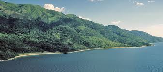
Lake Tanganyika is an African Great Lake With a maximum depth of 1470 m and an area of 32 900 km². Its volume of 18 880 km³ It is the second-oldest freshwater lake in the world, the second-largest by volume. It is the deepest lake in Africa and holds the greatest volume of fresh water, accounting for 16% of the world’s available fresh water. Tanganyika is considered one of the most biologically rich lakes on the planet. According to the World Conservation Union (IUCN), “no place on earth holds such a variety of life.” Of the 2000 plus species found in the lake, over half are found nowhere else. At least 90% of the water influx is from rain falling on the lake’s surface and at least 90% of the water loss is from direct evaporation. The clear waters host more than 350 different species of fish and is well known for aquarium fish exports and excellent angling. The major river flowing into the lake is the Ruzizi River, formed about 10,000 years ago, which enters the north of the lake from Lake Kivu. Lake Tanganyika has a remarkably uniform temperature. The lower regions are only a mere 3° C colder than the surface.
The reason for this strange phenomenon has yet to be discovered. The lake has a complex history of changing flow patterns, due to its high altitude, great depth, slow rate of refill, and mountainous location in a turbulently volcanic area that has undergone climate changes. Lake Tanganyika is an ancient lake. Its three basins, which in periods with much lower water levels were separate lakes, are of different ages. It’s water tend to be brackish. Though fed by a number of rivers, the lake is not the centre of an extensive drainage area. The largest rivers discharging into the lake are the Malagarasi, the Ruzizi, and the Kalambo, which has one of the highest waterfalls in the world (704 feet [215 metres]). Lake Tanganyika is also an evolutionary showcase due to its great age and stability. Ninety eight percent of the lake’s cychlids (which comprise two thirds of all the lake’s fish) are unique to Tanganyika. Also endemic are all seven of its crabs, five out of the thirteen bivalve molluscs, more than half of its gastropod molluscs and eleven of its thirty three copepod crustaceans. Sport fishing is very popular here and catches include the goliath tigerfish and Nile perch.
6.Lake Baikal
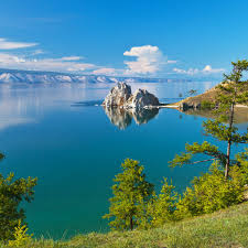
Situated in south-east Siberia, the 3.15-million-ha Lake Baikal is the oldest (25 million years) and deepest (1,700 m) lake in the world. It is the largest freshwater lake by volume in the world, containing 22–23% of the world’s fresh surface water With 23,615.39 km3 (5,670 cu mi) of fresh water. It contains more water than the North American Great Lakes combined. With a maximum depth of 1,642 m (5,387 ft) Baikal is the world’s deepest lake. It is considered among the world’s clearest lakes. Baikal is home to thousands of species of plants and animals, many of which are endemic to the region. It is also home to Buryat tribes, residing on the eastern side of the lake, raising goats, camels, cattle, sheep, and horses, where the mean temperature varies from a winter minimum of −19 °C to a summer maximum of 14 °C. Known as the ‘Galapagos of Russia’, its age and isolation have produced one of the world’s richest and most unusual freshwater faunas, which is of exceptional value to evolutionary science. It is home to approximately 1,700 to 1,800 endemic plant and animal species. Lake Baikal has historically played a large role in the Russian imagination.
It represents the unspoiled beauty of Russia and is sometimes referred to as the Sacred Sea. It attracts more than 500,000 tourists a year. The lands around Lake Baikal are generally warmer than the rest of the area because large bodies of water have a moderating force. There are 27 mostly uninhabited islands in Lake Baikal. More than 300 streams and rivers feed into Lake Baikal, but the Angara River is the only outlet. It carries out about 60 cubic km (15.8 trillion gallons) of water per year into the Yenisei River. During the summer, when the lake is full of melted ice from the Siberian mountains, it is sometimes possible to see more than 130 feet (39 m) down. The stunning clarity is the result of the melted ice’s purity, plankton that eat floating debris and a lack of mineral salts in the lake , according to Baikal World Web. There are several theories about what could have caused the unification, including sinking earth, falling rocks, erosion and earthquakes. Likely, it was a combination of all factors. Lake Baikal is in a rift valley and up to 2,000 earthquake tremors are detected each year.
7.Great Bear Lake
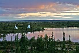
Great Bear Lake, lake in northern Fort Smith region and southeastern Inuvik region, Northwest Territories, Canada, lying astride the Arctic Circle. The Great Bear Lake is a lake in the Canadian boreal forest. It is the largest lake entirely in Canada. The fourth-largest in North America, and the seventh-largest in the world. The name originated from the Chipewyan language word satudene, meaning “grizzly bear water people.” The Sahtu Dene people are named after the lake. Grizzly Bear Mountain on the shore of the lake also comes from Chipewyan, meaning, “bear large hill.” Irregular in shape and containing many small islands, Great Bear Lake is roughly 200 miles (320 km) long and 25–110 miles (40–175 km) wide and has a maximum depth of 1,356 feet (413 m). Its area of 12,096 square miles (31,328 square km) makes it the largest lake entirely within Canada and the fourth largest in North America. The 70-mile- (113-kilometre-) long Great Bear River, which drains the lake westward through marshes into the Mackenzie River, forms an important transportation link during its four ice-free months.
8.Lake Malawi
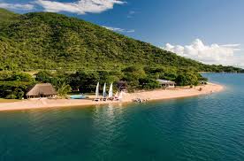
Lake Malawi is an African Great Lake and the southernmost lake in the East African Rift System, located between Malawi, Tanzania and Mozambique. Lake Malawi, also known as Lake Nyasa in Tanzania and Lago Niassa in Mozambique. It is the fourth largest fresh water lake in the world by volume. Lake Malawi is between 560 and 580 kilometers long and about 75 kilometers wide at its widest point. The lake has a total surface area of about 29,600 square kilometers. The lake is 706 m at its deepest point. This is the third largest and second deepest lake in Africa. Lake Malawi is a meromictic lake, meaning that its water layers do not mix. The property is an area of exceptional natural beauty with the rugged landscapes around it contrasting with the remarkably clear waters of the lake. Lake Malawi is globally important for biodiversity conservation due to its outstanding diversity of its fresh water fishes.
The property is considered to be a separate bio-geographical province with estimates of up to 1000 species of fish half occurring within the property, estimated as the largest number of fish species of any lake in the world. Endemism is very high: of particular significance are the cichlid fish, of which all but 5 of over 350 species are endemic. The lake contains 30% of all known cichlids species in the world. The property is also rich in other fauna including mammals, birds and reptiles. There are five villages included within enclaves inside the property. Here the soil is poor and crop failure frequency is high. Collaboration with the governments of Tanzania and Mozambique needs to be maintained and strengthened for the long term protection and management of the entire lake ecosystem, and consideration of the potential for its extension is required.
9.Great Slave Lake
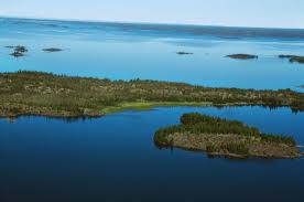
Great Slave Lake is the second-largest lake in the Northwest Territories of Canada. It is also the deepest lake in North America at 614 metres (2,014 ft), and the nineth-largest lake in the world. It covers an area of 28,568 km2 (10,502 sq mi) in the southern part of the territory. The lake shares its name with the First Nations peoples called Slavey of the Dene family by their enemies the Cree. This place gets in our soul. It’s the endless water and endless land. It’s that feeling you get when you take off from civilization with the roar of twin otter engines in your ears – and the freedom you feel once you arrive. Great Slave has been at the heart of history, culture and recreation in the Northwest Territories. Every year some 5,000 trophy fishers come North, many bound for the Great Slave’s North Arm and East Arm. Because the lake is clean and cold, fish keep near the surface in summer. Yellow Knife, the capital of the Northwest Territories, is an isolated mining town built on gold and now sustained by diamonds—an outpost of civilization surrounded by a vast, austere landscape of rock and tundra and water—most notably, the enormous Great Slave Lake, on whose shore the city is built. Yellowknife Bay shelters a fleet of more than two-dozen houseboats, all brightly painted and lovingly adorned. Residents run their floating homes on some combination of solar power and batteries. This pretty, nautical neighbourhood even hosts its own version of a drive-in film festival, albeit with canoes and kayaks. The lake is fed by several rivers, of which the Slave River from the south is the most important, and is drained to the west by the Mackenzie River, which eventually empties into the Arctic Ocean. Many of these communities depend on the lake for its abundance of fish, which helps drive the fishing and tourism industry.
10.Lake Erie
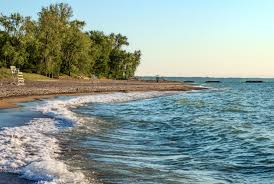
It forms the boundary between Canada (Ontario) to the north and the United States (Michigan, Ohio, Pennsylvania, and New York) to the west, south, and east. It is the southernmost, shallowest, and smallest by volume of the Great Lakes and therefore also has the shortest average water residence time. The major axis of the lake extends from west-southwest to east-northeast for 241 miles (388 km), and the lake has a maximum width of 57 miles. Approximately twelve million people live in the watershed, including seventeen metropolitan areas with more than 50,000 residents. The lake provides drinking water for about eleven million of these inhabitants. At its deepest point Lake Erie is 210 feet (64 metres) deep. The lake was named by the Erie people, a Native American people who lived along its southern shore. The tribal name “erie” is a shortened form of the Iroquoian word erielhonan, meaning long tail. The total area of the lake’s drainage basin is 30,140 square miles (78,062 square km), exclusive of surface area, which is 9,910 square miles.
Numerous new cleanliness and wellness policies and procedures have been put into place throughout the region to ensure that our guests not only have a fun and memorable visit, but a safe one. A place where time moves a little slower, loved ones feel a little closer and there’s a Great Lake between you and your worries. From island hopping to birdwatching, record-breaking roller coasters to water parks, wineries to dockside dining, plus hidden gems that keep the fun going all year long. Algae can persist for weeks during summer by blooms carried by winds and currents eastward through the lake. Eighty percent of Lake Erie’s total inflow of water comes through the Detroit River. Eleven percent is from precipitation (rain and snow). The remaining nine percent comes from the other tributaries
